Otripy
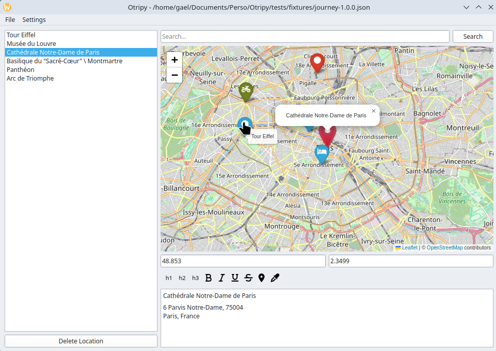
Otripy is a desktop application for trip planning. You plan a trip by adding locations on an OpenStreetMap map, each with a note: text with formatting and images. Trips are saved as files on your computer or on a Nextcloud server.
Otripy is developed and used daily on Linux, and packaged for Windows and macOS too.
Otripy is already usable but would be better with a lot of other features. Some wanted features are listed in the issues. Don't hesitate to open a new issue with your ideas, and to contribute them if you can!
Features
- OpenStreetMap map, with zoom and pan
- Add a location by clicking on the map: its note starts with the place's name and address
- Search places by name and add them from the results
- List of locations, reorderable by drag and drop; the first line of a note is the location's title
- Groups of locations, such as the days of the trip, and notes about the whole trip
- Notes with formatting (headings, bold, italic, underline, strikethrough) and images
- Marker icon and color for each location
- Open and save trips as local files
- Open and save trips on any Nextcloud server you have access to
- Distances and routes between locations, by car, bicycle or foot
- Export to map apps on phones, such as Organic Maps, to use the trip offline during the journey
Getting started
- Install Otripy on Windows, macOS or Linux.
- Learn how to use it: locations, notes, files and Nextcloud.
- Take your trip on your phone, to use it offline during the journey.
License
Otripy is Free Software, licensed under the GNU Affero General Public License, version 3 or later.
Credits
Otripy is developed and maintained by Kleag. Special thanks to all contributors!
Otripy builds on:
- Map data © OpenStreetMap contributors, available under the Open Database License. Place search and addresses come from OpenStreetMap's Nominatim service, used under its usage policy.
- Routes are computed by the FOSSGIS OSRM servers behind openstreetmap.org, used under their usage policy.
- Maps are displayed with Leaflet, through folium, with markers from Leaflet.awesome-markers.
- Marker and toolbar icons are Font Awesome Free icons by Fonticons, Inc., licensed under CC BY 4.0 (see the icons' license notice).
- The toolbar code comes from Notolog Editor by Vadim Bakhrenkov, under the MIT License (see the notice in toolbar.py).
- The user interface uses Qt through PySide6.